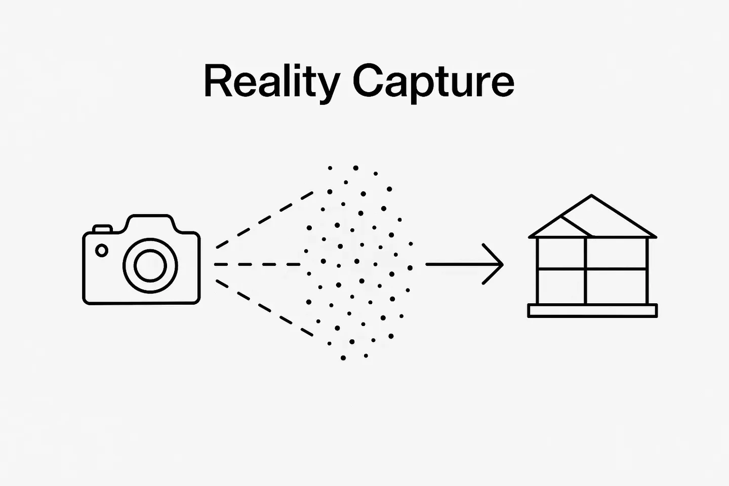
GIS BIM Integration - Uniting Spatial and Building Data
Digital transformation in the construction and real estate industry is driven by combining different data worlds. Two of the most powerful sources for datasets are Building Information Modeling (BIM) and Geographic Information Systems (GIS). Connected, these two systems create a seamless data environment of both the building and its larger spatial context.
This synergy is known as GIS BIM integration.

What is BIM and GIS integration?
BIM focuses on the detailed design, planning, and management of buildings throughout their entire lifecycle. It provides rich information about geometry, materials, mechanical systems, and asset management. BIM is what you build.
GIS, on the other hand, provides spatial data, such as topography, environmental conditions, infrastructure networks, and urban surroundings. GIS is where you build.
Where BIM is a representation of the building’s DNA, GIS shows the landscape that shapes its life.
GIS BIM integration connects these two worlds. High-precision building models merge with location-based environmental data, enabling decisions that consider both micro-level building details and macro-level spatial context.
How can GIS improve the accuracy of BIM building data?
While BIM models are highly detailed, they are usually created in isolation from the real environment. GIS adds essential layers of accuracy by:
- Providing georeferenced coordinates that ensure BIM data aligns precisely with real-world spatial systems.
- Adding environmental context like soil conditions, flood zones, wind patterns, and sunlight exposure for better planning and risk analysis in the BIM model.
- Improving data validation. By overlaying BIM designs with GIS datasets, potential conflicts (e.g., underground utilities or zoning restrictions) can be detected early.
The overall result of BIM GIS integration is a more reliable and context-aware digital representation of buildings. This, in turn, significantly improves both planning and long-term operations, as we’ll explore.
Benefits of GIS BIM integration
The AEC industry is already familiar with the integration of GIS and BIM. The toolset has been used largely in the design and construction phases of projects to improve coordination and collaboration among stakeholders and design more resilient projects. The integration also holds multiple benefits for operations and facilities managers, which we discuss further down.
The high-level benefits of GIS BIM working together combine integrated insight and efficiency, and increased sustainability and resilience.
- Holistic decision-making – Combines detailed building information with larger spatial context.
- Risk reduction – Identifies potential conflicts between design and environment before construction begins.
- Lifecycle optimization – Supports building operations and maintenance with environmental insights.
- Sustainability – Provides a foundation for energy modeling, environmental impact analysis, and smart city initiatives.
GIS BIM’s individual stakeholder benefits highlight enhanced collaboration across sites and better design resiliency. The toolset also offers significant reported benefits for facility managers and operations tasks, with valuable use cases emerging and adoption continuing to grow.
- Design consultants report increased project resiliency and better managed project complexity
- Construction professionals attribute faster approvals and reduced site conflicts to the integration, as well as easier field coordination
How to technically integrate GIS and BIM
To realize the value of this toolset, stakeholders must operate in an environment that does not silo data. The seamless integration of GIS and BIM requires a combination of common standards and interoperable technologies.
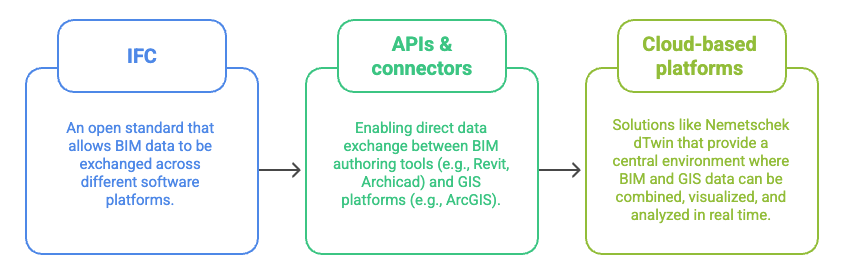
- IFC (Industry Foundation Classes): An open standard that allows BIM data to be exchanged across different software platforms.
- APIs and connectors: Enabling direct data exchange between BIM authoring tools (e.g., Revit, Archicad) and GIS platforms (e.g., ArcGIS).
- Cloud-based digital twin platforms: Solutions like Nemetschek dTwin that provide a central environment where BIM and GIS data can be combined, visualized, and analyzed in real time.
By using open standards and cloud platforms, stakeholders can better support collaboration and reduce information silos by ensuring that data flows seamlessly across disciplines. At scale, this integration can expand BIM’s advantages from buildings to entire cities, as demonstrated in Helsinki.
Real-world example: Smart urban development in Helsinki
The City of Helsinki is a leader in applying GIS BIM integration to urban development. The municipality has already combined BIM data from new residential and commercial buildings with GIS datasets on infrastructure, transportation networks, and environmental conditions to better manage urban development.
This integration has enabled planners and engineers to:
- Simulate urban heat islands by combining building geometry with GIS-based climate data.
- Optimize transport connectivity by aligning BIM building entrances with GIS transport flows.
- Support sustainability goals by evaluating solar potential on rooftops with geospatial accuracy.
The outcome: better-informed city planning, reduced risk in project execution, and improved quality of life for residents. Helsinki’s initiative has become a model for other smart cities across Europe.
Benefits for building operations and facility management
The value of GIS BIM integration goes far beyond planning and construction. Following project handover, integrated GIS and BIM solutions enable owners and operators to analyze lifecycle data for better decision-making. The points below highlight where these tools add the most value for facilities managers.
- Asset tracking: GIS can map and track building components and assets within a spatial context, making it easier to locate, monitor, and manage them.
- Predictive maintenance: By combining BIM data with GIS information on environmental influences (e.g., humidity, wind exposure), facility managers can predict when assets are likely to fail and streamline and schedule inspections and maintenance proactively.
- Energy optimization: GIS data on climate and orientation can be connected with BIM-based energy models to monitor and control a building's energy consumption. A single source of truth facilitates cross-disciplinary decision-making to better optimize heating, cooling, and lighting strategies.
- Emergency response: Integrated spatial and building data support enhanced safety evacuation plans and indoor emergency spatial models. This leads to faster evacuation planning, fire response, safety monitoring, and potential disaster damage assessment.
Overall, the system’s real-time monitoring, visualization, and analysis reduce costs in a multi-pronged strategy that improves sustainability and creates a more comfortable and safer environment for occupants.
Nemetschek dTwin: The platform for GIS BIM integration
While the concept of GIS BIM integration can be achieved through different technologies, a real-world application requires a platform that seamlessly connects both data worlds. This is where Nemetschek dTwin comes in.
As a cloud-based digital twin solution, dTwin enables the integration of BIM models with GIS datasets in real time. Stakeholders can visualize building information in its true geospatial context, enrich models with environmental data, and use these insights for planning, construction, and long-term building operations. From asset tracking to energy optimization, dTwin provides a central hub for data-driven decision-making across the entire building lifecycle.
FAQs
What industries benefit most from GIS BIM integration?
Architecture, engineering, construction (AEC), urban planning, and facility management gain the most value.
Is GIS BIM integration only relevant for large projects?
No, smaller developments can also benefit from significant risk and cost reduction. For example, the integration can help ensure compliance with zoning regulations or optimize building placement on a plot.
What technologies are required for GIS BIM integration?
Cloud-based platforms such as Nemetschek’s dTwin provide the environment for combining GIS and BIM data, enabling seamless analysis and collaboration.