360° Photogrammetry of Buildings
360° photogrammetry is used in architecture, construction, archaeology, and virtual reality to create accurate and immersive 3D representations. In photogrammetry for buildings, the method enables fast, cost-efficient capture of existing structures and their conversion into precise digital 3D models.
What is 360° Photogrammetry?
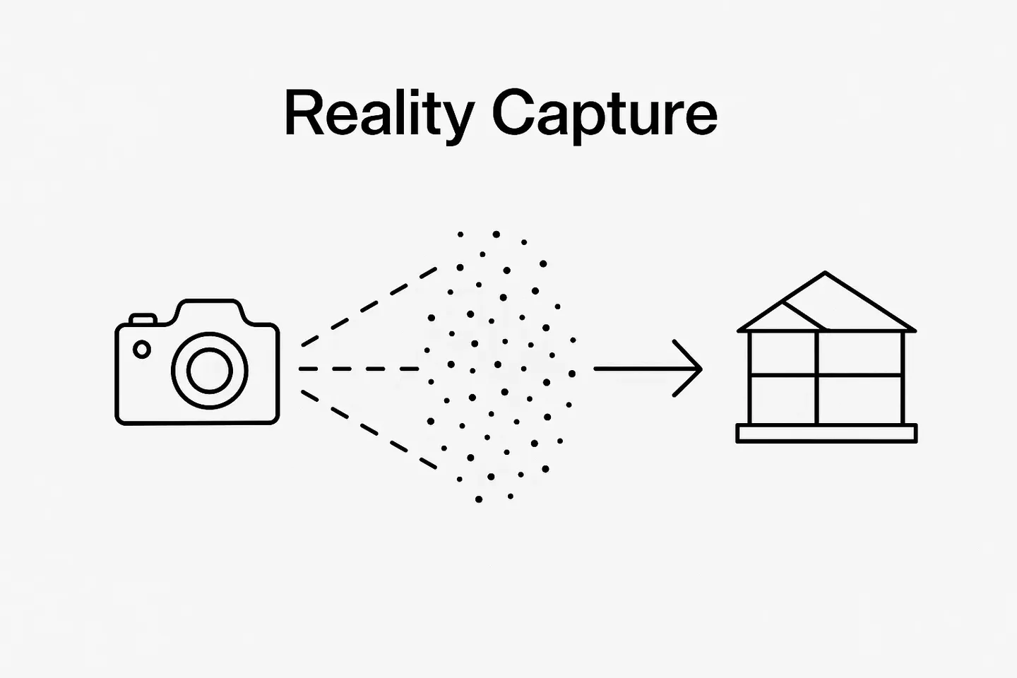
360° photogrammetry is a technique that involves capturing multiple overlapping photographs of an object or scene from different angles to create a detailed 3D digital model. This method combines principles of photography, mathematics, and computer vision to extract three-dimensional information from two-dimensional images.

Learn more
Do you want to learn more about how 360° Photogrammetry helps you to get an overview about your buildings?
Learn moreHow to create a 360° Photo Walkthrough?
1. Image Capture: Multiple photos are taken from various angles around the object or scene.
2. Processing: Specialized software identifies common points in the images and calculates their spatial relationships.
3. 3D Model Creation: The software reconstructs the geometry of the object or scene, creating a detailed 3D model.
4. Creating the Walkthrough: The stitched images are converted into a virtual tour, creating a navigable walkthrough experience
Types of 360° Photogrammetry
-
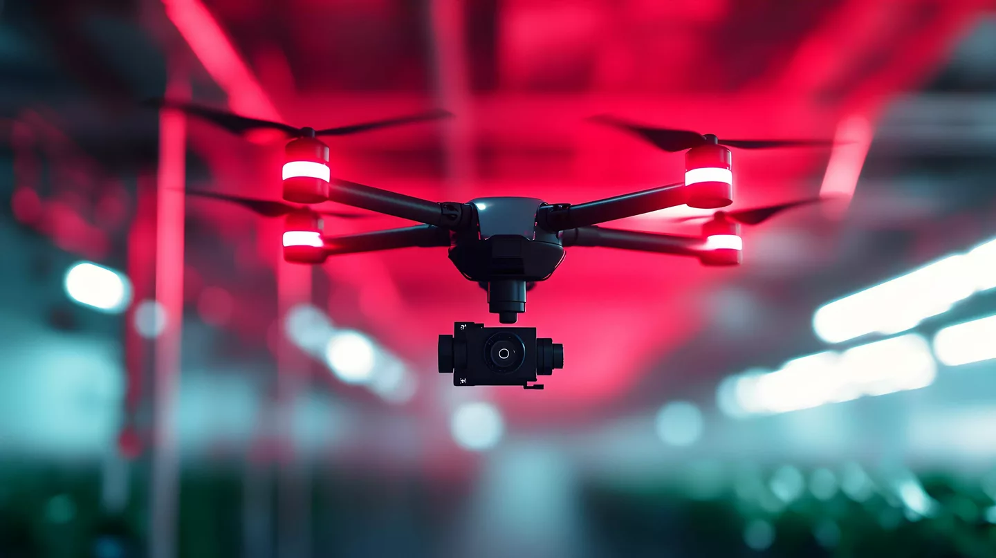
This involves capturing images from elevated positions using drones, airplanes, or satellites. It's commonly used for large-scale mapping and surveying.
-
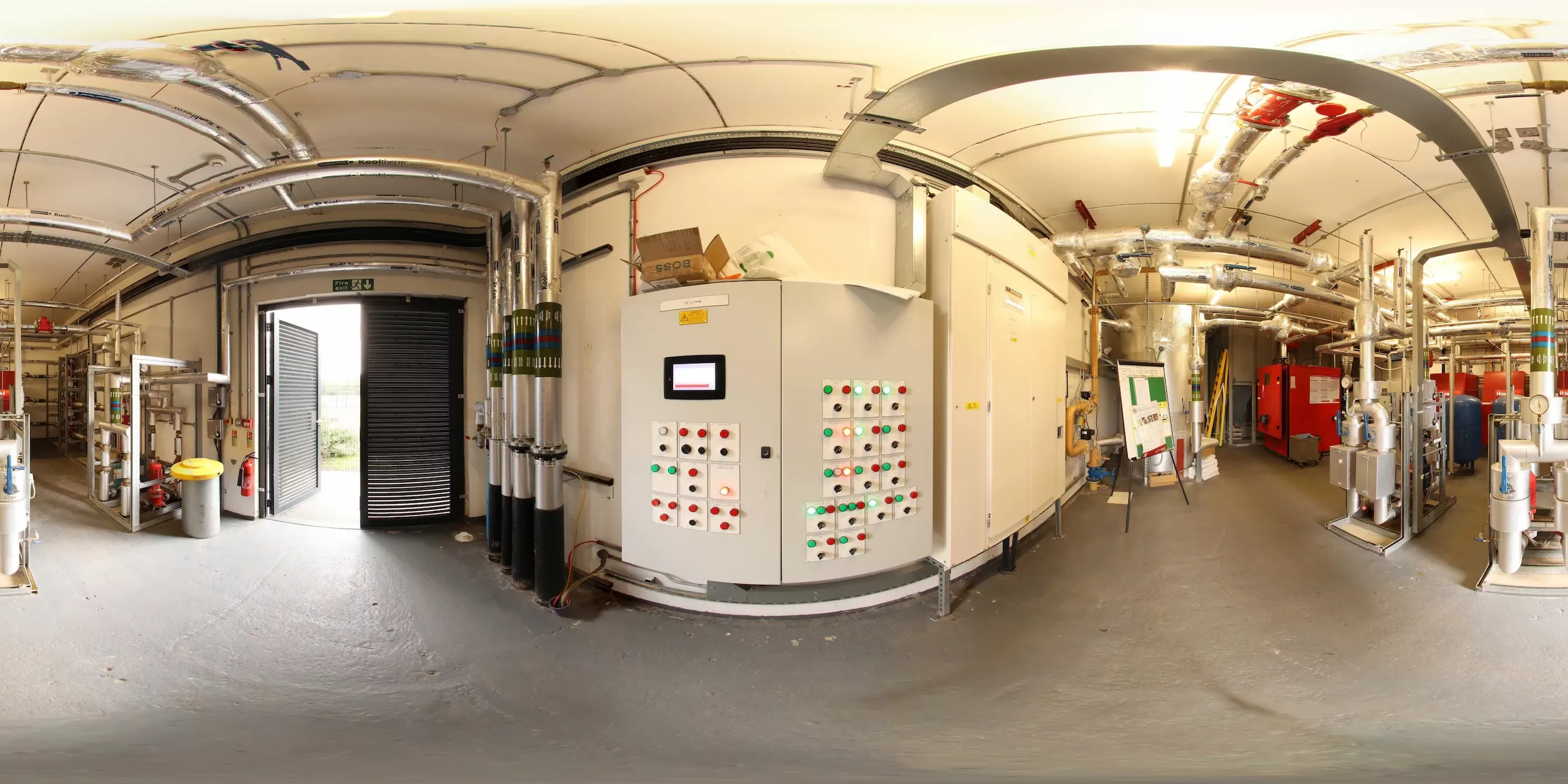
This method uses ground-based cameras to capture images. It's often used for detailed documentation of buildings, archaeological sites, and other structures.
-
This type focuses on capturing detailed images of smaller objects or specific parts of a structure. It's frequently used in fields like forensics, cultural heritage preservation, and manufacturing.
-
This involves using mobile devices or handheld cameras to capture images. It's useful for quick and flexible data collection in various environments.
Benefits of 360° Photogrammetry for Building Management
-
It provides high-definition, time-stamped visual records of every aspect of a building, replacing traditional, error-prone documentation methods.
-
Detailed, immersive visuals facilitate better communication among stakeholders, ensuring everyone has a clear understanding of the building's status and needs.
-
Managers can monitor building conditions and progress remotely, reducing the need for frequent site visits and enabling timely decision-making.
-
It simplifies compliance with regulations by providing verifiable evidence of site conditions and changes over time.
-
By capturing comprehensive views of building components, 360° photogrammetry helps identify maintenance issues early, allowing for proactive repairs and reducing downtime.
How dTwin uses 360° Photogrammetry?
dTwin uses 360° photogrammetry to build the visualization of the built asset. The 3D photos are combined together to a 3D replica of the building you can view and walk through it. This can be the sole basis for visualization or can be combined with BIM models or point clouds. The different types of visualization can be overlayed and compared.
IoT sensors can be linked to the visualization resulting from laser scanning. This allows real-time data to be localized and visualized via heatmaps. But many other data such as normal photos, videos, descriptions or technical specifications can also be linked to the point clouds.
Learn more
Do you want to learn more about how dTwin visualizes your built assets with 360° Photogrammetry?
Learn moreFAQs about 360° Photogrammetry of Buildings
-
While laser scanning measures precise distances using laser beams, 360° photogrammetry reconstructs 3D models from overlapping photographs. Photogrammetry is often faster and more cost-efficient, while laser scanning delivers higher geometric precision. Many digital twin solutions, like dTwin, combine both methods for optimal results.
-
The accuracy depends on the camera resolution, image overlap, and processing algorithms. In controlled environments, 360° photogrammetry can achieve accuracies within a few millimeters, making it suitable for building documentation, renovation planning, and facility management.
-
Most 3D photogrammetry workflows allow exports in common formats such as OBJ, FBX, PLY, or LAS, enabling seamless integration with BIM software, CAD environments, or visualization tools like dTwin.
-
Yes. Close-range or terrestrial photogrammetry is ideal for indoor environments, where drones cannot be used. 360° cameras capture complete rooms with minimal blind spots, allowing for detailed spatial documentation and virtual walkthroughs.
-
Typically, a 360° camera or DSLR setup, a tripod, and photogrammetry software are required. For larger assets, drones or mobile platforms are used. The captured images are then processed digitally to create 3D point clouds or textured models.
-
Captured 3D data can be uploaded to platforms like dTwin, where it can be combined with other visualization types and further processed into a virtual replica of the building. Users can then connect additional layers such as BIM data, IoT sensor readings, or maintenance information to create a digital twin for interactive facility management.
-
Photogrammetry requires sufficient lighting, surface texture, and image overlap. Highly reflective or transparent materials can reduce accuracy. In such cases, combining photogrammetry with laser scanning ensures complete and reliable 3D results.